
The Land of Oak & Iron is set around the beautiful steep-sided Derwent Valley, with an abundance of natural woodland, rare and iconic wildlife, and a hidden heritage of British sword making and a world leading iron and steel industry.

Geology is important to The Land of Oak & Iron because it has provided the coal, iron ore, water power and timber that have created the local landscape and industries. Most of the rocks are from the Carboniferous Period, when this area was usually covered in tropical forests. The oldest of these rocks, at Shotley Bridge and upstream, are quite hard and were used to make millstones for grinding corn. In these same strata are the ironstones which were used in the early days of our iron and steel industry.
Lower down the Derwent Valley, the coal seams are thicker and more frequent. This coal fuelled the early industrial processes and produced the enormous wealth of the local landowners. It has left us a heritage of disused waggon ways and railway lines, most notably the Derwent Walk.
Natural Landscapes

Derwent Gorge & Muggleswick Woods
Derwent Gorge and Muggleswick Woods is a National Nature renowned for its ancient oak woodlands, diverse flora and fauna, and scenic gorge landscape, situated near the village of Muggleswick; it’s particularly known for its rich birdlife including red kites, buzzards, and woodland warblers, with the River Derwent running through the reserve.
The reserve is considered one of the best ancient oak woodlands in northeast England. There are dry, acidic oak woods on higher ground and wetter, lime-rich ash and alder woodlands on lower slopes.
The River Derwent runs through the gorge, offering opportunities for riverside walks. Red kites, buzzards, spotted flycatchers, wood warblers, dippers, kingfishers, red squirrels, and roe deer.

Shibdon Pond
One of the best wetland sites in the region; regionally important for its high number of bird species. Shibdon Pond is one of the few large open water bodies left in the Tyne valley and is one of the best wetlands in the region for wintering wildfowl.
Large numbers of wetland birds are recorded here including lapwing, golden plover, redshank, snipe, teal as well as water rail, sand piper and kingfisher. The summer attracts martins, swifts and swallows and in winter, cormorants roost alongside occasional rare visitors such as Iceland gull.

Butterfly Bridge
The original bridge was built in 1842 by local strongman and stonemason Jack English. Lang Jack as he was known, also worked on the original Scotswood Bridge. His bridge was destroyed by flood in 1902. The replacement bridge was destroyed by flood in 1950, only to be destroyed in 2008. The current bridge was built in 2011, this time without a central pier to avoid further damage.
Near to the Bridge are the remains of the house of Flour Miller George Eavan’s. This was the last remaining property at the village established by Crowley.
On old maps the place is marked as Eel’s Haugh. The name Butterfly Bridge supposedly comes from the fact that the Derwent Valley was a butterfly collector’s paradise and enthusiasts began their expeditions from the bridge. The previous bridge dated from 1950.

The Spetchells
The Spetchells are chalk waste heaps from a chemical factory that operated on a nearby site until the mid-1960s. The name comes from old maps that refer to this area of land as the ‘spetchells’.
Although the heaps are not natural, they now provide Northumberland’s largest area of chalk grassland habitat. The wide range of flowers attracts many species of common and, occasionally, rare butterflies.
Built Landscapes


Nine Arches
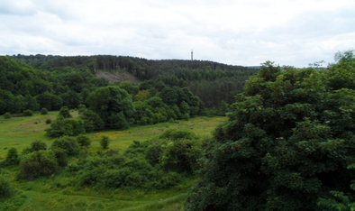
When it was proposed to build a railway “Blaydon and Conside’ railway to carry Swedish iron ore from the Tyne to the steelworks at Consett, the original route would have been visible from Gibside Hall. Forceful objections came from two influential people: John Bowes, then owner of Gibside, and his stepfather, Sir William Hutt, who lived there. As a result, two viaducts and a deep cutting had to be constructed to hide the railway from the Hall.
Built in 1867, the viaduct is 500 feet long and stands 80 feet above the river. The very last passenger service passed over the viaduct on 1 February 1954. The railway finally closed in 1963. Nowadays, the Nine Arches Viaduct survives as a testament to the magnificent engineering skills and vision that went into building the Derwent Valley Railway: the old trackbed was transformed into the Derwent Walk and became part of the national cycle network, traffic is on foot, bicycle or horseback. From the viaduct’s heights there are spectacular views of the Gibside Estate, now owned by the National Trust.
The railway is commemorated in the Geordie folk song about an ill-fated train journey from Rowlands Gill, Wor Nanny’s a Mazer.

Hollinside Manor
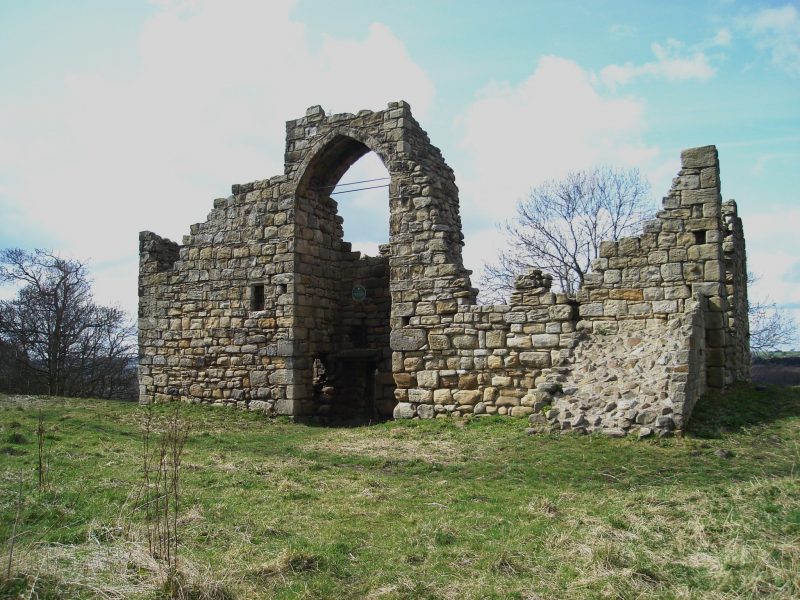
Hollinside Manor (Old Hollinside) is a well-preserved 13th century fortified manor house situated east of the Nine Arches Viaduct, on the edge of a steep brow with commanding views of Derwenthaugh Country Park and the surrounding countryside. It was the home of the Harding family for two centuries during which time the manor became known as the ‘Giant’s Castle’ since the men folk were very tall.
The estate passed on to George Bowes of Gibside in 1730 for the sum of £10,000. Today the manor is on the English Heritage At Risk register, and listed a Grade 1 ancient monument. It can be accessed easily from the Derwent Walk: visitors can examine the inside of the building and admire the view. Recently Gateshead Council received £40,000 to do some renovation work on the building. Read more about the Giants of Hollinside in Tales of Derwentdale, a publication of The Land of Oak & Iron Trust.


Hownsgill Viaduct
This railway viaduct is sited at a curve of the river and was built as part of the Consett Branch of the North Eastern railway. Originally a single line, it was widened to take a double track in 1905-08. Built mostly of sandstone with bricks beneath the nine arches it is 500 feet long and 80 feet above the river.
There is a deep cutting, 60 feet in depth and half a mile long, west of the viaduct at Lockhaugh and together these features form an attractive part of the Derwent Walk. From the viaduct’s heights spectacular views are obtainable of the Gibside Estate to the southwest. The house and grounds there were created by coal owner George Bowes whose father had inherited the estate.
Tree planting, a chapel, stables, an orangery and banqueting hall were all George’s developments as was the most prominent feature to be seen from the viaduct, the statue of British Liberty on the hillside opposite.
The monument is 140 foot high and topped by a 12 foot statue of a lady carved in situ with a protective shed around it, it cost about £2000 in all in 1757. The trees on either side of the valley here are particularly pleasing in autumn. Bird watcher’s use the viaduct as a vantage point from which to look out for the red kites which have recently been introduced into the valley. Recent publicity material refers to the bridge as the Nine Arches Viaduct.

Cherryburn
Thomas Bewick, the famous artist and naturalist, was born in this modest farmhouse in 1753. He grew up here, making close observations of the natural world around him and life on the banks of the River Tyne.
He later became internationally renowned for books of exquisite wood engravings of animals and birds. The peaceful garden and wonderful views of the Tyne Valley make this a great place for a family day out. Site managed by the National Trust.

Prudhoe Castle
Prudhoe Castle has many a story to tell so a family day out to this Northumberland fortress is truly worthwhile.
Bult as part of a series of Norman Castles along the Tyne after the 1066 Norman conquest, Prudhoe was continuously occupied for over nine centuries. It was originally the home of the Umfravilles but was eventually taken over by the famous Percy family who restored it. Prudhoe survived two sieges during the 1170s and was the only Northumberland castle to resist the Scots.

Visit our Industrial History
Towns and Villages

Consett
Like many towns in The Land of Oak & Iron, Consett’s infrastructure history is tightly bound up in its natural resources and the consequences of their exploitation: what became known as a steel town was originally a few scattered hamlets built on ironstone. In the Boldon Book of 1183, it appears as Conekshued: by Tudor times, it was known as Conside, and still sparsely populated.
In 1840, The Derwent Iron Company was formed from a few small companies to join forces and more effectively quarry and smelt local ironstone. This led to a boomtime for the area, bringing in new workers from all over the UK, and later Ireland. Once the local ironstone was exhausted, the company was instrumental in developing railway networks in order to access further supplies. The Consett Iron Company was established in 1864, owning seven collieries and coke ovens. In 1947, they went into the ownership of the National Coal Board, and in 1951, the Consett Iron Company became part of the nationalised Iron and Steel Corporation.
Industry started to dwindle when the pits started to close: by the 1970s, there were no working mines. After the works were Nationalised the compnay could no longer hold on to its specialists and work began to be given out to other parts of the steel industry in other areas. Parts of the Works, such as the Rolling Mills, began to close. Despite energetic and vocal opposition, the works were closed in 1980, resulting in the loss of 3,700 jobs, a devastating blow from which Consett struggled to recover.


Victoria Garesfield
When Garesfield Colliery opened in1870 a village grew up close by to house the miners and their families. In the earliest days of the village, two streets appeared: Chopwell Cottages and Cowen’s Row. With 346 miners employed soon after its beginnings, Victoria Garesfield’s highest employment point was in the early 1900s, a result of the onset of the First World War. At the time of its closure in 1962, it provided employment for some 205 men.
As much of the coal in the area was high quality coking coal, ideal for the malleable iron founding industries of County Durham, in 1861/2 the Marquis of Bute had 193 bee-hive coke ovens built at Whinfield, (LINK) half a mile from Victoria Garesfield on the track which took their coal to the Tyne.
Whilst these ovens had initially been supplied from Chopwell, with the opening of Victoria Garesfield colliery in 1870, it in turn became the main supplier, most of the coking coal extracted from its Victoria and Brockwell seams. A waggonway to transport the coal from Victoria Garesfield to Whinfield was built the same year and remained in operation until 1962.
At Victoria Garesfield, there were stables in front of the aptly named ‘Stable Row’, where 12 or so ponies that worked at the Victoria seam were housed. Underground, inside the pit itself, there were also stables for some 20 to 30 ponies that were used to work the Brockwell seam. These stables were whitewashed to provide extra light, as the only time the ponies were taken outside was during the two weeks holidays at the pit in the summer.
The ponies were otherwise kept in excellent conditions, given the importance of their role as a vital work tool. Pit ponies were generally put to work from the age of four and retired in their early teens.
Methodist Chapels were a common feature of mining communities and Victoria Garesfield was no exception. The Methodist movement believed in saving the soul of the labouring poor; their ‘God’ was a ‘God’ of the oppressed; against the tyranny of the rich. A Primitive Methodist Chapel was built at Victoria Garesfield in 1885. In the 1920s and 1930s all chapels had good congregations and were the social centres for many people in their villages.
That this colliery village was all but demolished following the closure of the pit, may also lie in the fact that the village had, in essence, been little more than a temporary ‘work camp’; its community, as with all mining communities, having simply been located where there was coal to be mined, destined to move on once reserves had been depleted.Looking at the preserved haven of the village as it is today, it can only be considered a blessing that no property development has been permitted, and that Victoria Garesfield, the small, rural colliery village that meant so much to so many – was returned to nature

Winlaton & Blaydon
In 1692, the hill village of Winlaton was the original site of Ambrose Crowley’s ironworking activities, with a proliferation of blacksmiths’ workshops making simple items, notably nails. Support from local landowners provided ready access to the proliferation of available natural resources. The business rapidly expanded down into the Derwent Valley to access the power of the river, where a slitting mill was built with more housing for the workforce at what came to be called Winlaton Mill.
Crowley’s business acumen brought imported skills to develop the local workforce, fulfilling lucrative Royal Navy contracts: he was soon master of a devoted, hardworking and thriving community. The export route was originally downhill to the Tyne staithes at Blaydon, where the Crowley warehouse stood at the mouth of Blaydon Burn until the middle of the C20th, by which time Blaydon itself had hugely expanded from a transit point on the outer bend of a tidal river, mostly populated by keelmen, to a structurally reinforced, heavily industrialised riverside community


